Products
CATEGORY-1 PRODUCTS
MarineStream®
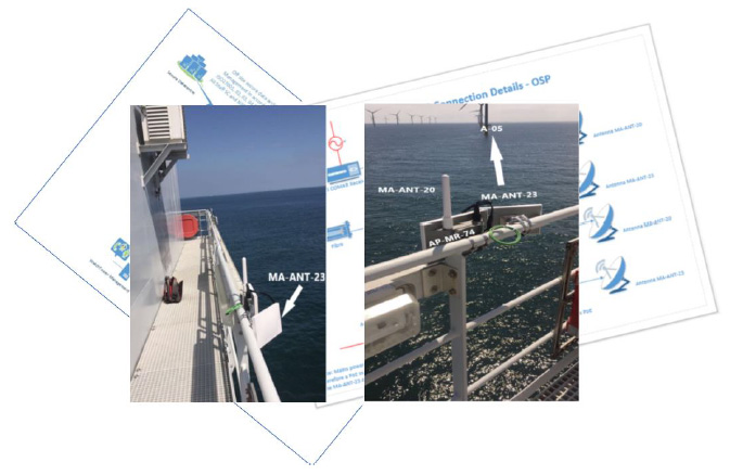
Remote RF wifi-mesh network:-The establishment of a robust multi-layered communication network and application of current off-the-shelf technology to the offshore windfarm environment provides a gateway to numerous wifi/LoRa/IoT-based technologies, and in doing so will create additional supply chains and of course enable the means for the improvement of current onshore health and safety processes and procedures to be immediately extended to Offshore Renewable Energy Installations (OREI’s).
WatchTower©
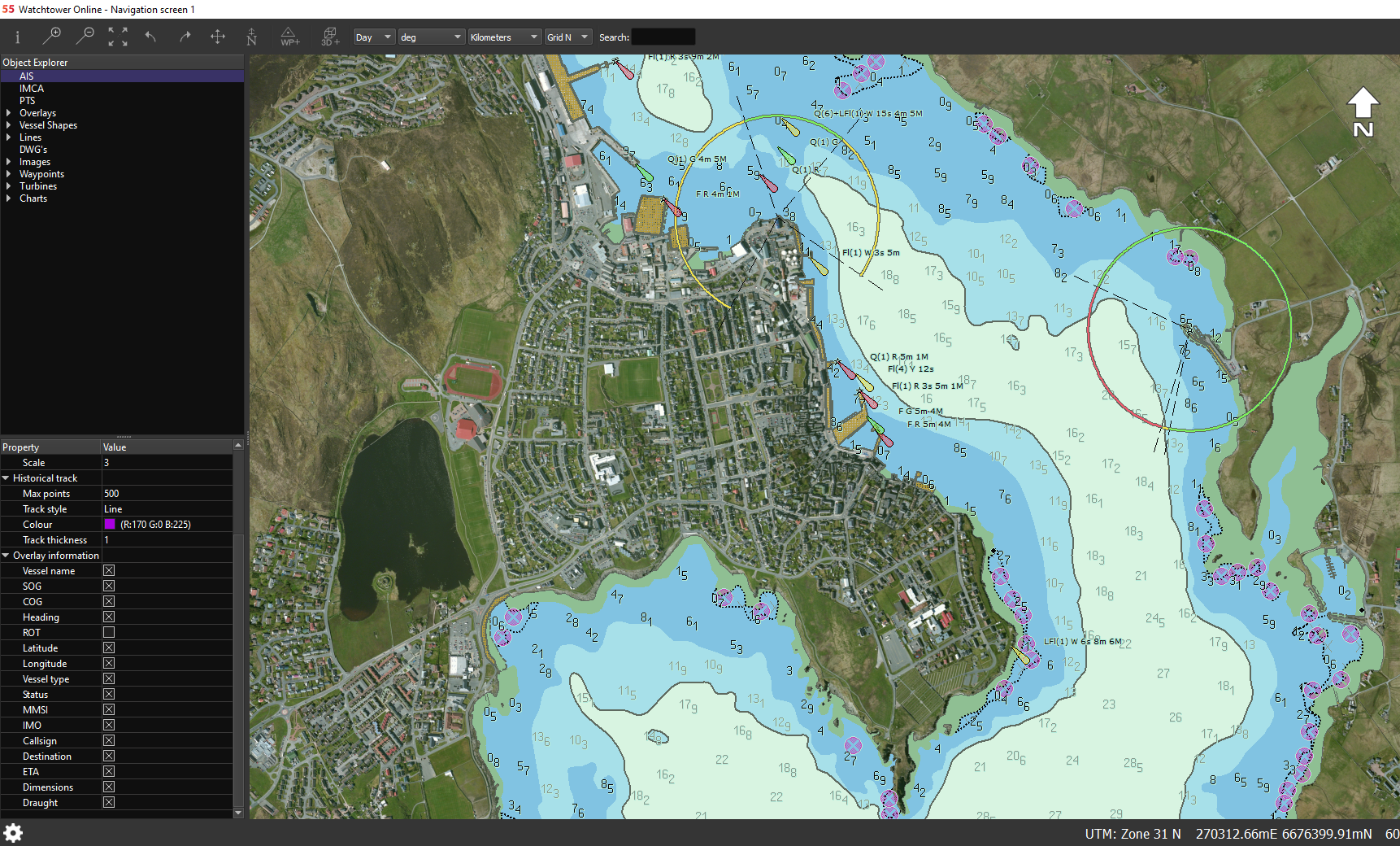
Marine Coordinator Control Software Suite (GUI)system:-The WatchTower software suite utilises an approved ECDIS display library for the display of official Electronic Nautical Charts (IHO & IMCA compliant), which is used to support the following registered applications; Naval Combat Systems, Harbour and Coastal Surveillance, Training and Simulation Systems, Search and Rescue (SAR) services.
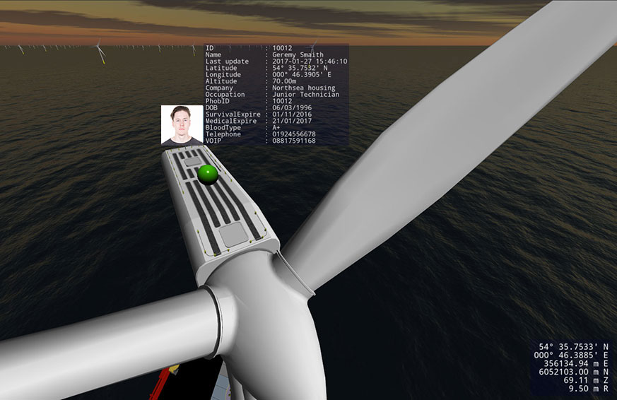
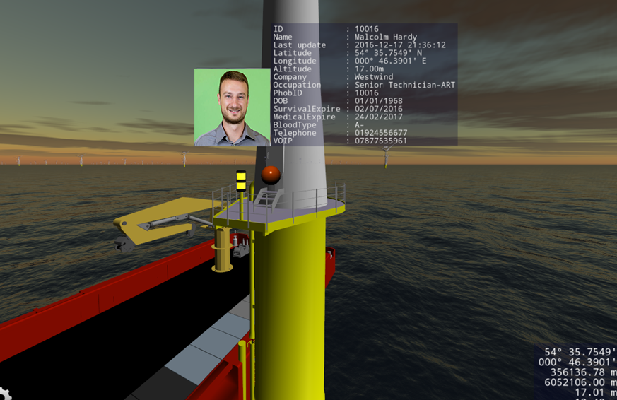
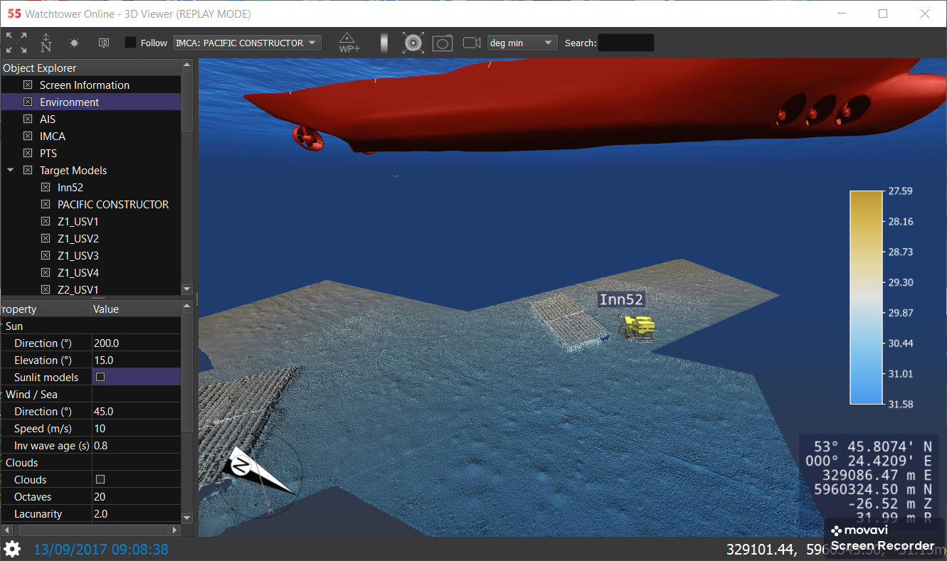
WatchTowerCollates; ECDIS, ASZM, VTS, AIS, PTS, 2D-3D, on surface and subsurface vessel/vehicle tracking, DTM and georeferenced-data imagery. All this data is presented in a real-time digitally-twinned environment.
In the event of a situation, which requires the assistance of the search and rescue services, the F55 system is aligned to interface with the IHO ECDIS systems employed on coast guard helicopters and lifeboats. Notice To Mariner (NTM) alerts are consistently and automatically updated within the ECDIS system, to ensure that all navigation hazards are made available to those navigating the relevant work site regions.
Temporary Exclusion Zones or regions can be manually drawn within the GUI then be easily exported and utilisedfor the production of Notice to Mariners (NTM), for IHO, IMCA (ECDIS update) if so required.
Also unlike traditional AIS systems, sub-surface vehicle positions, such as Remotely Operated Vehicles (ROVs) or Divers, can also be integrated into the remote tracking system and be displayed in the MCC – WatchTower© Suite. This facility not only provides the Operator/Coordinator within the onshore Control Centre (MCC) with the position and status of all in field vessels and vehicles, but it allows the Coordinator to consistently evaluate operations ‘above and below’ the water surface in relation to prescribed safety parameters and productivity considerations.
CATEGORY-2 PRODUCTS
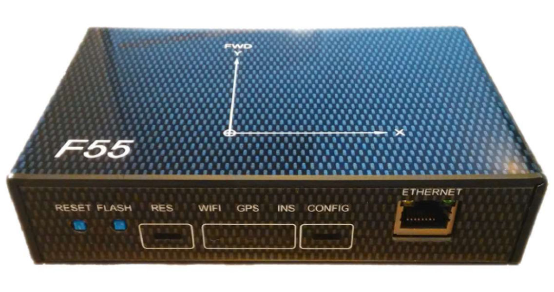
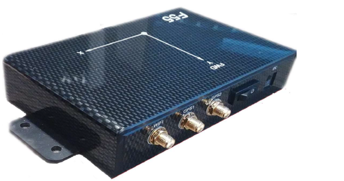
F55 – Vessel Tracking System (VTS)
The VTS device/unit will not only provide near real-time GPS location, vessel heading, pitch, roll and heave parameters continuously updated via prescribed MCC software, but the modular design will allow for a range of available and progressive communication conduits/protocols if the available Client based communication infra-structure should be upgraded in the future.
Currently employed AIS web-based systems are not engineered to relay such information in near real-time and therefore limit the applicability to the evolving safety guidelines and regulations (IMCA, SOLAS, Section 95 and Schedule 16 of the UK Energy Act 2004).
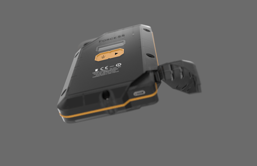
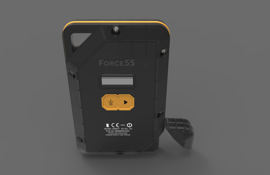
F55 – Personnel Tracking System (PTS)
The PTS fob device not only provides near real-time GPS location, continuously illustrated via prescribed MCC software, but the modular design also allows for a range of available and progressive communication conduits/protocols.
RF based communication conduits allow for additional data to be relayed via the PTS device to the available Client based RF network e.g. Government Guidelines RR446 – Fatigue Risk Index and Risk Potential refers to signature indicators such as body temperature and heart-rate. This kind of biosensor data could be communicated through this device by design and provide personal status in relation to the fatigue risk index. Current swipe-card RFID systemsare not engineered to relay such information continuously to the MCC, and thus are not catering for the evolving safety guidelines and regulations (IMCA, SOLAS, Section 95 and Schedule 16 of the UK Energy Act 2004).
The PTS fob device is prescribed with a dedicated IP address, this address will link to a secure Client Based data-base, which facilitates the Operator/Coordinator with instant on-screen access to information. Such expedient access to mobile data increases functionality and allows the Operator to make informed decisions, such as the coordination of Search and Rescue services in the event of an accident.